
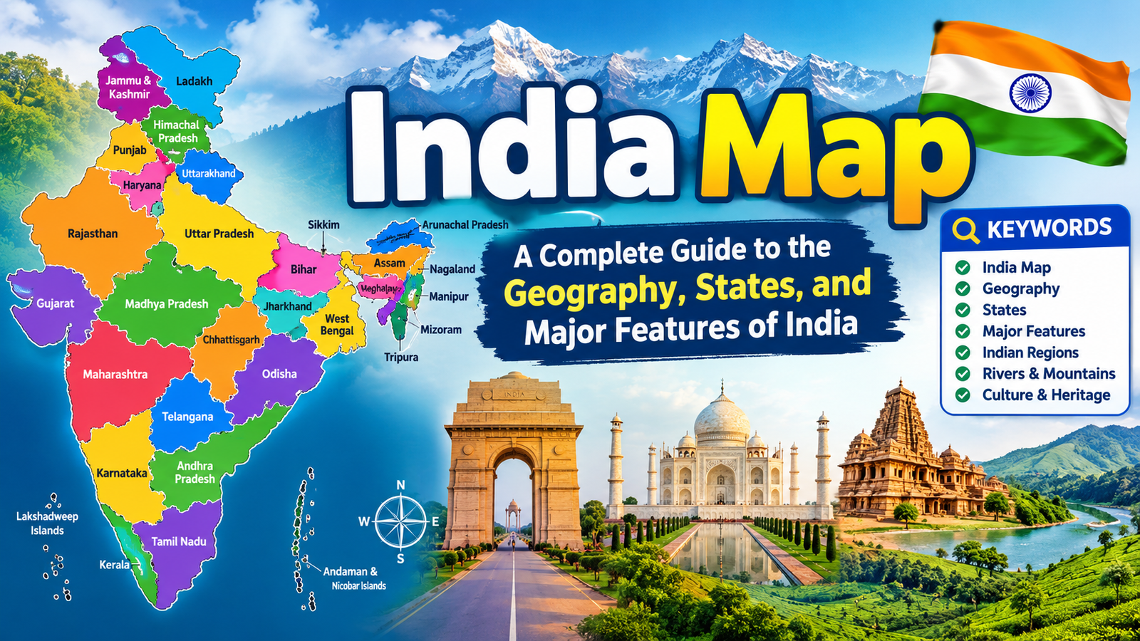
The India Map provides a detailed visual representation of one of the world’s most geographically diverse countries. India is located in South Asia and is known for its vast land area, varied landscapes, rich cultural heritage, and numerous states and union territories. A map of India helps students, travelers, researchers, and geography enthusiasts understand the country’s location, boundaries, physical features, cities, rivers, mountains, and administrative divisions.
Whether you are looking for a political map, physical map, road map, state map, or geographical map, understanding the basic features of an India map can make it easier to explore the country.
List of Important Topics on an India Map
- Location and geographical position of India
- States and union territories
- Major cities
- Neighboring countries
- Mountain ranges
- Major rivers
- Plains and plateaus
- Coastal regions
- Islands
- Major geographical regions
- Political and physical maps
- Importance of the India map
Geographical Location of India
India is situated in South Asia and occupies a major portion of the Indian subcontinent. It is surrounded by the Himalayan mountain range in the north and the Indian Ocean in the south. The Arabian Sea lies to the southwest, while the Bay of Bengal is located to the southeast.
The geographical position of India gives it a diverse climate and landscape. The country stretches from the Himalayan mountains in the north to tropical coastal areas in the south. The India map clearly shows this north-south diversity and helps identify the country’s position within Asia.
India shares land borders with several countries, including Pakistan, China, Nepal, Bhutan, Bangladesh, and Myanmar. It also has maritime boundaries with neighboring countries across the surrounding seas.
States and Union Territories of India
A political India map shows the administrative divisions of the country. India is divided into 28 states and 8 union territories. Each state has its own government and administrative structure, while union territories are governed under arrangements established by the central government, with some having elected legislatures.
Some of the major states shown on an India map include Rajasthan, Maharashtra, Gujarat, Madhya Pradesh, Uttar Pradesh, Bihar, West Bengal, Odisha, Tamil Nadu, Karnataka, Kerala, Telangana, Andhra Pradesh, Punjab, Haryana, Assam, and others.
The union territories include Delhi, Jammu and Kashmir, Ladakh, Chandigarh, Puducherry, Lakshadweep, Andaman and Nicobar Islands, and Dadra and Nagar Haveli and Daman and Diu.
A state-wise map is particularly useful for students because it makes it easier to learn the location and boundaries of different administrative regions.
Major Cities on the India Map
India has many important cities that play significant roles in government, business, education, technology, tourism, and culture. New Delhi is the national capital and an important political center.
Other major cities include Mumbai, Kolkata, Chennai, Bengaluru, Hyderabad, Ahmedabad, Pune, Jaipur, Lucknow, Surat, Kanpur, and Kochi.
A detailed city map can help identify the location of these urban centers and understand their relationship with surrounding states and geographical regions.
Neighboring Countries of India
The location of India becomes easier to understand when its neighboring countries are identified on a map. Pakistan lies to the northwest, while China, Nepal, and Bhutan are situated along the northern boundary. Bangladesh and Myanmar are located toward the east.
The northern boundary is dominated by the Himalayas, which form a major natural geographical feature. The southern part of India extends into the Indian Ocean, making the country a peninsula.
Studying an India map together with a map of South Asia provides a broader understanding of India’s geographical and strategic position.
Major Mountain Ranges
Mountains are an important part of India’s physical geography. The Himalayas are the most prominent mountain system and extend across the northern part of the country.
The Himalayan region contains some of the world’s highest peaks and plays an important role in India’s climate, rivers, agriculture, and ecosystems.
Other important mountain ranges include the Aravalli Range, Western Ghats, Eastern Ghats, Vindhya Range, and Satpura Range. These features can be identified more easily on a physical map of India.
Major Rivers of India
India has an extensive network of rivers. Many rivers originate in the Himalayas, while others rise in the central and southern parts of the country.
Important rivers include the Ganga, Yamuna, Brahmaputra, Indus, Godavari, Krishna, Narmada, Tapi, Mahanadi, and Kaveri.
The Ganga is one of India’s most important rivers and flows through several northern states before reaching the Bay of Bengal. The Brahmaputra is another major river associated with the northeastern region.
River maps are useful for understanding agriculture, settlements, transportation, irrigation, and the development of civilizations.
Northern Plains of India
The Northern Plains are among the most fertile regions of India. They were formed largely by sediments deposited by major river systems such as the Ganga, Yamuna, and Brahmaputra.
The plains cover extensive areas of northern and eastern India. Because of fertile soil and access to water, this region supports large populations and extensive agricultural activity.
On a physical India map, the Northern Plains appear between the Himalayan region and the Peninsular Plateau.
Peninsular Plateau
The Peninsular Plateau occupies a large portion of central and southern India. It is one of the oldest geological regions of the country.
The Deccan Plateau is a major part of this region and extends across several southern and central states. The plateau contains various mineral resources and is also important for agriculture.
The Western Ghats and Eastern Ghats form important boundaries around portions of the plateau. Their location can be clearly understood using a physical geography map.
Coastal Regions of India
India has a long coastline along the Arabian Sea, Indian Ocean, and Bay of Bengal. The western coast includes regions such as Gujarat, Maharashtra, Goa, Karnataka, and Kerala.
The eastern coast includes West Bengal, Odisha, Andhra Pradesh, and Tamil Nadu. Major coastal cities and ports have developed along these areas.
The coastline has contributed significantly to India’s trade, fishing, tourism, transportation, and cultural connections with other parts of the world.
Islands of India
India also includes several important island groups. The Andaman and Nicobar Islands are located in the Bay of Bengal, while Lakshadweep is situated in the Arabian Sea.
These islands are important for biodiversity, tourism, maritime geography, and national security. An India map that includes islands provides a more complete picture of the country’s geographical territory.
Political Map vs. Physical Map of India
Different types of India maps are designed for different purposes. A political map focuses on states, union territories, boundaries, capitals, and major cities.
A physical map, on the other hand, highlights natural features such as mountains, rivers, plateaus, plains, deserts, and coastal areas.
A road map focuses on highways, roads, transportation routes, and cities. Similarly, thematic maps may show rainfall, population, agriculture, climate, minerals, or other specific geographical information.
Importance of the India Map for Students
The India map is an important educational tool. Geography students use maps to learn state boundaries, capitals, rivers, mountains, neighboring countries, and physical regions.
Map-based learning can make geographical information easier to remember because students can connect names with actual locations. Maps are also frequently used in school examinations, competitive examinations, quizzes, and general knowledge activities.
By regularly studying an India map, students can develop better spatial awareness and a stronger understanding of the country’s geography.
Importance of the India Map for Travelers
Travelers can use maps to plan journeys between cities, states, tourist attractions, national parks, historical sites, and coastal destinations.
A road map can help travelers understand distances and transportation routes, while a physical map can provide information about mountains, valleys, deserts, and other natural features.
For international visitors, an India map is also useful for understanding the country’s enormous geographical diversity.
Conclusion
The India map is much more than a simple representation of the country’s boundaries. It provides valuable information about India’s states, union territories, cities, rivers, mountains, plains, plateaus, coastlines, islands, and neighboring countries.
From the Himalayan mountains in the north to the Indian Ocean in the south, India contains an extraordinary variety of landscapes and geographical features. Political maps help explain administrative divisions, while physical maps reveal the country’s natural environment. Road and thematic maps provide additional information for travel, education, planning, and research.